
For those of you who are not familiar with North Dakota, in the western part of the state there are mostly flat prairie grasslands with very few trees. In the distance, here and there you will see buttes which range in size from one hundred to two hundred feet tall. If you go far enough, the grasslands come to an end and you reach the “badlands”.
The badlands consist of many miles of dry, sandy, barren, steep deep ravines and sharp peaks. If you think that North Dakota is sparsely populated, the badlands are mostly vacant of people. There are more rattlesnakes in the badlands than people.
There are/were a small number of people who like living in the badlands. There is so much vacant land that it was a good place to graze cattle. Cattle ranching required horses and cowboys. So there you go, that’s the kind of people who live in the badlands, horses and cowboys, still to this day.
Since 2011, on and off I have had to work in or travel through the badlands. There are some oil wells and pump jacks in the North Dakota badlands. In the Summer of 2012 I worked in an oil field in the desert of west Texas where it was extremely hot, dry, and there were very few people. In remote west Texas you have to be very aware all the time that it is so hot and there are so few people that if you become injured or stranded you could die before anyone finds you. Similar thing in the North Dakota badlands.
The area that I am going to show pictures of in this blog post article, it is kind of dangerous because it is so hot, so barren, there are so few people, and the people in this area don’t like outsiders. For a little while, I considered writing out driving directions for how to get to this location, but I soon changed my mind because people would not fully understand how much trouble that they could get into.
The first time that I rode my motorcycle in this area, I was not sure where I was going because all of the internet maps are incorrect. As I was finding out that the maps were incorrect, the few local people became aware of me riding around, and got in their trucks to see where I was going and what I was doing, so I thought that I had better leave and try again another day.
Here is a photo on my way to the secret badlands lake. The nearest gas station or convenience store is at least fifty miles away:

Here is a photo of an old house on the way to the lake. If the landowner would have seen me taking this photo, he probably would have tried to shoot me:

There is a one-track road that splits off the main road, and winds around for about a mile before you first see the secret badlands lake:
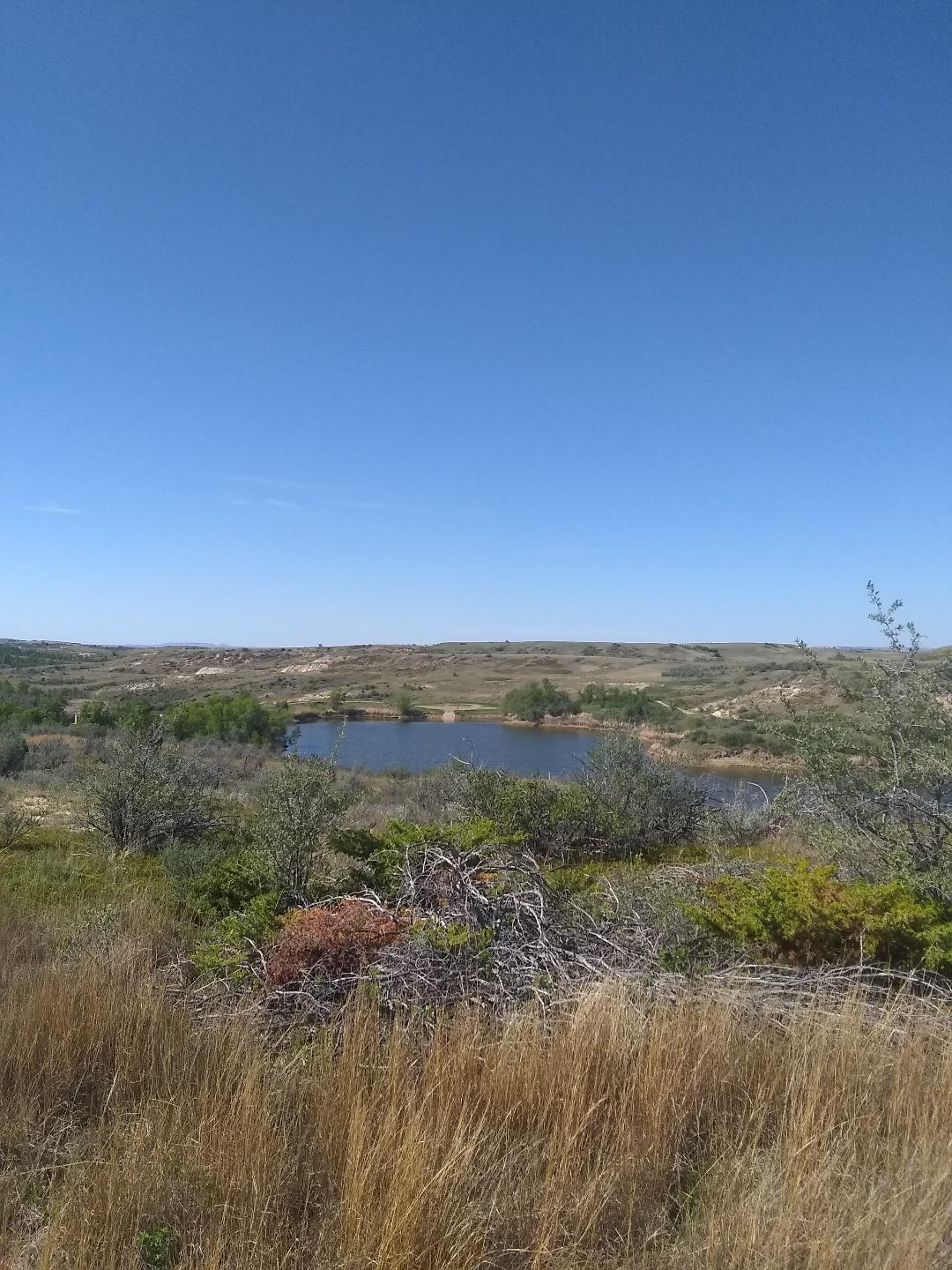
The badlands are so sandy, dry, hot, and barren, with so little water, that is seems like a miracle when you get a look at this lake in-person:
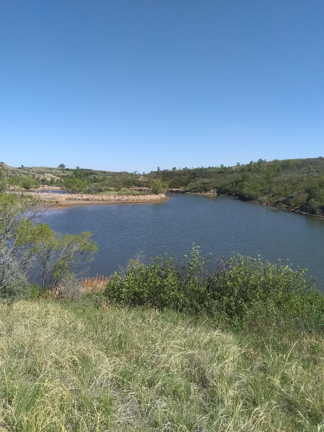
When I arrived at this lake on a mid-afternoon week day, I was hoping to find one or two young naked cowgirls who were in a good mood from cleaning off and cooling off in the water, and were leisurely drying themselves and tanning themselves in the sun. But I don’t know where they were:

Besides me not wanting to tell people where this is, so that they don’t get lost or stranded and die, I kind of wanted to keep this to myself so that I can go swimming here alone and enjoy the peace and quiet. But I can’t really go swimming here by myself like I want, because the local people here would shoot me like a turtle.

Hi, nice photos. I like reading about places that are geographically unusual and off the beaten track. The next state bordering on North Dakota to the west is Montana–do the badlands continue across the state line to places like Glendive, or do the scenery and climate gradually change? And how is it near the Canadian border in the north? Regards.
LikeLike
William G.,
I found this comment of yours in my Spam folder, this happens sometimes. To answer your question about how far west the badlands continue, in the area that I have been riding lately adjacent to the Little Missouri River, from what I can see the badlands in southwest North Dakota continue at least another 10-15 miles on the west side of the Little Missouri River, but I can’t say exactly where and how far because I haven’t been that far west lately. I looked on a satellite image map, and from this map you can see how close the badlands come to the Montana border https://www.google.com/maps/@46.9499536,-103.6558922,34243m/data=!3m1!1e3
LikeLike